Showing posts with label Cessna 172. Show all posts

Saturday, August 26, 2017

We're now officially a flying family

Plane: Cessna 172 
Route: 40I, Local 
Weather: Clear, 69 degrees, wind 070 degrees at 5 knots

I've been hinting at this for a while now. Of course, I wanted to feel 100% current and fully in possession of all my flying faculties prior to taking our little girl flying. Parenthood has a way of shining the spotlight on conscientiousness and responsibility.

She was all decked out in appropriate attire

Mariella was in a rather good mood this evening (per usual - we really did get lucky as she's quite the happy baby) as we got her changed into a proper first flight outfit. Gina and her said hello to everyone in the office while I preflighted the airplane. Once everything was ready, I carried her over to the 172 and buckled her car seat into the back of the plane. She fell asleep not long after.

Strapped in and sound asleep

Gina buckled herself up next to Mariella in the back and I ran through my checklist and started the engine. Apparently the little one perked up with the noise of the engine but quickly nodded off again. Gina ended up cutting down some regular ear plugs for Mariella's tiny ears, since the baby headset I bought is too wide on her head when she's wedged into the infant car seat.

Her reactions on short final and landing are priceless (about 1:10 and 1:35 in the video)

Once I was completely sure the plane and passengers were all ready to go, I taxied onto Runway 8 and we took off into the calm evening sky. Mariella was awake at this point and stared at Gina while chewing on her hand - a favorite pastime - as we climbed out. She seemed pretty content.

A happy family together at 2,500 feet

I made very shallow turns and leveled at about 2,500 feet. It was already late in the evening so I anticipated a short flight from the start. Nonetheless, I heard a few cries behind me as we flew down the valley so I turned gently back towards Stewart about five minutes after takeoff. Turns out someone decided to convert the clean diaper to the non-clean variety; that usually results in notable crankiness.

Passing by the lake on our way back to Stewart

A great sunset for moving into our next chapter of flying

We were on short final about ten reasonably good minutes later. Mariella was still a little fussy, as expected, but she really did quite good overall. Gina gave her a pacifier and that kept her calm for the most part. She made some pretty good bug eyes when the main wheels touched the bumpy turf, too.

So, as the title of this post says, we're now officially a flying family! We'll be flying commercially next week so we'll see how that goes - but I think it goes without saying that I couldn't let Delta have the honor of providing my daughter's first flight. I was pretty impressed with the little squish on her first aerial experience. Here's hoping this is just the start of a long, long tradition of family flying adventures.

Flight Track: Google Earth KMZ File 
Today's Flight: 0.4 hours
Total Time: 379.1 hours

Friday, August 25, 2017

Flight: Reviewed

Plane: Cessna 172 
Instructor: Tommy
Route: 40I-I19-40I
Weather: Scattered clouds, 71 degrees, wind 070 degrees at 4 knots

At some point in the past month, I received one of those handy email currency reminders from my electronic logbook. But I've finally been flying again and I know I've made more than enough takeoffs and landings for currency purposes, so I thought it must be an error? Turns out, when you don't fly for the better part of a year, those two years between BFRs sneak up on you.

I have taken a variety of courses to earn FAA WINGS credit, so the knowledge portion of my currency is, uh, current. However, for what I hope are obvious reasons, the FAA likes pilots to go up in the air and actually prove they can still fly with a CFI. I planned to do so a week ago but I was sick (food poisoning is no fun) and had to reschedule. Tommy thankfully had enough free time this evening to fit me in, so we met after work and got to it.

A checkride's worth of maneuvers in one GPS track

The long and short of tonight's flying is that it was a much-needed and very good review. Despite my recent logbook additions, I am clearly still rusty in some areas. Overall, I am just nowhere near as smooth and fluid as I can be when I'm notching regular time in the left seat. Tommy did a great job running me through a whole bunch of maneuvers and offering important reminders and tips.

We started off with a soft field takeoff, during which I climbed out of ground effect too quickly. It feels strange to push the nose over so much after rotation to fly level along the ground (and it doesn't help that the ground quickly slopes downhill ~15 feet on Runway 8 at Stewart) but that's what you're supposed to do; we tried this again later. Next, we flew east and I successfully demonstrated steep turns, slow flight, and power-off/on stalls.

Tommy suggested going to Greene County; the winds were calm but he spotted a plane waiting to take off near the end of Runway 7 so I crossed midfield and entered the pattern. He asked for a short field landing so I used all 40 degrees of flaps and touched down within 200 feet of the numbers. It wasn't my best, though, and improved speed control and a touch less power on short final would've let me perfectly plant it. While taxiing back for takeoff, he asked me what I would do if my elevator jammed and we discussed that scenario for a few minutes...

Back in the pattern, he informed me that my elevator was now jammed (courtesy of him holding the yoke to prevent me from pushing or pulling it) and I needed to land. I explained my plan, which was to use the trim and power while flying a longer final approach to help ensure things were as stabilized as possible. I throttled back, slowly lowered the flaps as I made my way around, and hit the stop on the trim while on final. On very short final, I tested kicking in a burst of power to raise the nose and it seemed to work, so that was my plan in the flare. We crossed the numbers in a roughly level attitude at about 65 mph. Entering ground effect, I pushed in throttle for a second or so, and the extra power slightly raised the nose so the mains touched just before the nose wheel. The landing was honestly pretty smooth - yes, we planted it on the runway, but it wasn't a total carrier landing. Most importantly, I actually landed the airplane without using my elevator!

I really want to thank Tommy for the simulated elevator jam exercise. I've certainly thought about what would happen if I lost a control before but never tried to actually simulate it in flight. He said one of his old instructors did the same thing and I absolutely agree it's great practice.

After taking off again, I put on the hood and we did a little simulated instrument work. It's been way too long since I last did that so it was also great practice. Sidenote - training for my instrument rating is finally in my near-term plans. My skills are crude at best but I managed to turn to headings and climb/descend per his instructions. Then he gave me a few unusual attitudes to recover from and I successfully did so.

Before long, we were back at Stewart. Tommy pulled the power on me abeam the numbers and I made a safe simulated engine-out landing. The next time around, after doing a better job with the soft field takeoff, I attempted a soft field landing. I leveled off a tad too high and didn't add enough power to achieve a perfectly soft touchdown, but I held the nosewheel off and it was good enough to call it a day.

Currency and proficiency are more important to me than ever now that I'm responsible for our entire growing family whenever we fly. Beyond simply having a calmer work schedule that should allow more flying, I really hope to finally start training for more advanced ratings. But regardless of when that commences, tonight was a great refresher that left me legally current for the next 24 months.

Flight Track: Google Earth KMZ File 
Today's Flight: 1.1 hours
Total Time: 378.7 hours

Saturday, August 5, 2017

Currency, Part 1: Taking the 172 all over town

Plane: Cessna 172
Route: 40I-I73-I44-3I7-I62-MGY-40I
Weather: Scattered clouds, 75 degrees, wind 260 degrees at 8-12 knots

What do you do when mom and baby are out of town for the day? You fly, of course. Couple that with a list of local airports you've never landed at despite being a pilot for over eight years and you've got yourself a mission!

It's already been over a month since I last flew. Much better than earlier this year, but still more of a gap than I'd like. So this seemed like a good way break up the takeoff ans landing practice with a (tiny) bit of pilotage and navigation.

I popped into about half the airports around Dayton today

I departed Stewart and first landed at Moraine Airpark (I73) for the first time since 2009. Coming over the levee on very short final, the rising air caused me to briefly float down the runway before touching down relatively softly. Takeoff was smooth and I climbed straight out to 1,700 feet (per the A/FD and sign at the end of the runway) before turning north.

The first new airport was Dahio Trotwood (I44), a notably run down strip that's so desolate it's a tad hard to spot from the air at first. The runway is so cracked that I deemed it smart to first do a low approach and check for any obvious problems or obstructions. I didn't see anything that would preclude a landing so I circled back around and landed on Runway 22. It's an interesting place - corn rises up on both sides so you can't see much of anything once settled on the as-bumpy-as-expected runway. I back-taxied and departed on the same runway without ever seeing any signs of life.

Next up was Phillipsburg (3I7), which was acquired by a local business owner a few years ago to prevent closure of the airport. It's not the busiest place but here there were clear signs of life; a Cherokee called in 10 miles away when I was in the pattern and landed after me. The runway is pretty narrow (reminds me a little of 45G in Brighton, MI) and the shifting winds during my roundout led to probably the worst landing of the day. Again, I back-taxied after the Cherokee was clear and took off again on the shortest leg of the day.

My final new airport was Brookville Air-Park (I62) and it's only a very short 3.4 nm flight from Phillipsburg. This is another unique, lightly used local strip. The runway and airport are actually separated by a road; to cross you pull up to a gate that opens and there are stop signs to remind you to yield to the cars driving by. You also pass quite close to some tall trees off your left wing when landing on Runway 27. The pavement is somewhat bumpy but my touchdown was reasonably smooth; again, I back-taxied down the runway and took off to continue my little local adventure.

Since I'd be passing right by Wright Brothers (MGY) and haven't landed there in nearly a year, I planned it as my final stop on the way home. It's 19 nm from Brookville so I had a few minutes of level cruise to just enjoy the view and relax. The pattern was busy as usual; I crossed midfield behind two other planes in the pattern to land on Runway 20. I landed a tad firm in the slight crosswind. Seeing two or three other planes lined up on the taxiway while I was in the pattern, I'd decided not to wait in line. As soon as the flaps were raised up, I pushed full throttle back in and was soon flying the final leg back to Stewart.

Before long, I was back in Waynesville. I spotted one of the jump planes quickly descending and called him on the radio to say I had him in sight and would follow him in - they have a way of zooming thru the pattern like rockets. I turned slightly right, then circled back to enter a 45 for a left downwind to Runway 26. With the wind almost directly down the runway, my final approach was stable and smooth and I touched down smoothly a few hundred feet past the threshold.

This was a lot of fun. I've been meaning to pop into some of these airports for years and I'm glad to finally have done so. I still want to try out the road-crossing at Brookville so I'll have to land there again some day. Just as exciting and important, I could feel the rust coming off the more I threw myself into both new and familiar situations. I think I'm now current enough in the 172 that Mariella's first flight will soon be in the cards...

Flight Track: Google Earth KMZ File 
Today's Flight: 1.4 hours
Total Time: 376.4 hours

Monday, July 3, 2017

Finally notching some Skyhawk time

Plane: Cessna 172
Instructor: Jamie
Route: 40I-I19-40I
Weather: Scattered clouds, 84 degrees, wind light and variable

It's been some time since I sat in the left seat of the Skyhawk, nearly 10 months in fact. Our return flight from Boston via Albany last year is the last time I was behind 14L's controls. Aside from the general lack of currency, I'd like to take Mariella for her first flight soon - and to do that, I need to be able to competently fly the 172 again.

Jamie texted me the other day to let me know he had an opening, as we've been trying to set this up for a couple weeks. I did a thorough preflight while we chatted on the ground. There was more than two hours of fuel onboard so once I fired up the O-300 we were ready to fly.

It was another great summer afternoon for aviating

I took off on Runway 26 and made two laps around the pattern. I came in a little low on the first one but managed to finish the approach with a smooth landing. The next time around was more stable and the landing was again quite soft. We then departed the pattern to the east, climbing up over the lake to do a few steep turns. While all were borderline acceptable, they were far from my finest. I'll have to put in a bit more time working on maneuvers next time I'm up in the sky practicing solo.

Today's vaguely triangular route across the countryside

Wanting to practice on pavement and having not been there in a while (the logbook says May 2013 when we met pilot friend Samuel there, in fact!) we decided to land at Greene County. I came in a tad fast and landed long but the touchdown was smooth. Lifting off again on Runway 25 on the subsequent takeoff, Jamie pulled the power and I touched back down on the pavement during the simulated engine failure. I departed again sans instructor shenanigans and climbed back to 2,000 feet and headed straight for Waynesville.

My final landing was probably the best of the bunch, with my speeds on target and a soft touchdown followed by the shortest rollout of the day. Similar to the Cub, it's crazy just how much flying the 172 is like riding a bike... it came right back to me even after a lengthy break. Obviously there's more than stick and rudder skills when it comes to currency but I'm looking forward to getting up again soon.

Flight Track: Google Earth KMZ File 
Today's Flight: 1.1 hours
Total Time: 375.0 hours

Monday, September 5, 2016

Meeting Emry: Day 4

Plane: Cessna 172
Route: ALB-TSO-40I
Weather - ALB: Clear, 72 degrees, wind 010 degrees at 6 knots
Weather - TSO: Clear, 86 degrees, wind variable at 3 knots
Weather - 40I: Clear, 84 degrees, wind calm

Waking up this morning, the first thing I did was open up ForeFlight and check the weather. No matter how much bugging out early yesterday was clearly the logical, safe, and correct decision... curiosity's hard to quell. I swiped east to the Boston area and saw that the storm system appeared to have moved a bit more offshore than forecast.

In short, we probably could've stayed overnight and made it out without issue this morning. It was a little windy but not that different than when we departed last night. Of course, I'm also decidedly not much of a morning person and leaving early (that weather's still moving inland) would have necessitated an earlier wake-up than was required in Albany.

The weather was still mostly offshore this morning

We were able to take our time getting ready and grabbed breakfast at the hotel. It was around 10:30 when we pulled out of the parking lot; we pulled into Million Air about 15 minutes later. They called National to come pick up the rental car and we headed out onto the tarmac to load the plane. After a preflight and pit stop, I settled the fuel bill and we climbed into the plane for our long leg home.

Writing on taxi diagrams on screen can be handy

Following a brief mental hiccup (calling Ground for clearance at a Class C airport - oops) I contacted Clearance, who gave us a squawk code, departure heading, departure frequency. Readback correct, I went back over to Ground, who quickly cleared us to taxi to Runway 1. We were sitting behind a Piedmont Dash 8 for a few minutes before they departed. Tower cleared us for takeoff another minuted later after another plane cleared the crossing runway.

It was a great flight home overall, though we did have trouble with one ATC handoff 


The weather was great - incredible visibility with just a few puffy clouds here and there. Tower handed us off to Departure, who cleared us on course about 10 miles north of the field just past Schenectady. We slowly climbed to 8,500 feet. I leveled there for a little while but the reported winds aloft were more favorable at 10,500... so I tried climbing up to check them out.

It took quite a while.

Turns out this old 172 seems to prefer the lower altitudes. We eventually got to 10,500 and our ground speed was basically the same as before, despite slightly reduced headwinds. I decided to wait for a bit to see how things went. Then I noticed I hadn't heard much from Albany in a while.

A bird's-eye view of the longest day I've ever spent in the left seat

There was occasional radio chatter but I couldn't really hear the controller. Seeing as we were nearly to Binghamton, I tried calling Binghamton Approach. No answer. Checking the charts, we were in New York Center's airspace, so I tried them. Again, no answer. Perplexed, I tried Binghamton again and finally got an answer.

I explained the predicament and lack of a handoff, but the controller just acknowleged our presence without any further discussion. Until about 2 minutes later when he came back, said we were hard to hear, and handed me back over to New York Center. Back over to them; this time they responded right back and we continued on our merry way. Same squawk code I dialed in before departing Albany and no further mention of any communication issues.

Elmira, NY from 10,500 feet

Continuing east, we were handed off from controller to controller until eventually reaching Pittsburgh, where I got cleared into the Class B airspace. We just skirted the north edge. The controller said he could just cut us loose at the edge of his sector if I was ok with that. I said that was fine, as we'd only be about 15 miles from our planned fuel stop by then. As we started our descent it got much warmer and bumpier as we dropped below about 6,000 feet.

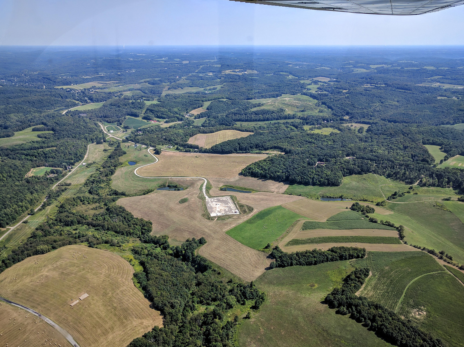
Typical wooded hills over central Pennsylvania 

Farms near the Pennsylvania / Ohio border east of Pittsburgh

Clear of Pittsburgh, I squawked VFR and got on the CTAF for Carrol County-Tolson Airport. Nobody was in the pattern as we entered from the northeast on a 45 for left downwind to Runway 7. I landed reasonably softly on the very nice, very new blacktop and taxied to the fuel pump. Another Cessna was there just finishing up replenishing their own stores of 100LL. He taxied away as I turned around and pulled up next to the pump.

The plane again took about as much fuel as expected. It's worth noting that ForeFlight was always within one gallon on its fuel usage numbers throughout the whole trip, which was nice to see. We were back in the air, this time departing straight out on Runway 25, about 20 minutes after arriving.

Atwood Lake, between New Philadelphia and Carrollton, OH

I contacted Akron-Canton Approach and they put us back in the system for flight following the remainder of the trip home. For this shorter leg I leveled at 6,500 feet. The bumps were nonstop during the initial climb but thankfully it was nice and smooth up there.

Approaching Columbus, we got another handoff and more scattered clouds began to appear. Most had bases at 7,000 feet or higher but I did have to make a couple small turns to remain clear where a few big puffy ones dropped down towards our altitude. We passed just south of CMH and downtown as we continued west towards Stewart.

CMH - recently renamed John Glenn Columbus Int'l Airport

Downtown Columbus from 6,500 feet

We got one final handoff to another Columbus Approach sector and controller partway home. I spotted Caesar Creek Lake maybe 25 miles out in the haze. About 15 miles out I began our final descent into the warm air; the AWOS at Wright Brothers was reporting very light winds so I anticipated the traffic at 40I would be landing to the west per usual during calm winds. I descended down to pattern altitude flying about a mile north and parallel to the runway to visually check for the usual allotment of NORDO traffic.

Almost home - somewhere between Columbus and Dayton

A plane I didn't recognize was departing the airport (easy to identify thanks to the N Number displayed on my iPad's screen) to the west. He made a departure call on the CTAF and I replied saying we had him in sight and would make a crosswind entry to the left downwind for Runway 26 behind him as he climbed westward. Turning final, I was at least 100 feet high, but I added in all the flaps to drop in over the trees. We touched down long but softly on the familiar turf.

Safely back on the parking pad at Stewart

By the time we were on the ground at Stewart the Hobbs meter had officially christened this the longest flight I've ever made in a single day. A little more research shows that the previous record-holder (5.2 hours on the way home from Upstate NY five years ago) is in fact still the longest by distance at roughly 580 nm compared to about 525 nm today. Nonetheless this was quite a haul; I was more than ready to relax after 14.4 hours in less then three days!

Flight Track: Google Earth KMZ File 
Today's Flight: 5.6 hours
Total Time: 372.0 hours

Sunday, September 4, 2016

Meeting Emry: Day 3

Plane: Cessna 172
Route: OWD-ALB
Weather - OWD: Clear, 70 degrees, wind 060 degrees at 10 knots gusting to 18
Weather - ALB: Few clouds, 79 degrees, wind 350 degrees at 5 knots

Since arriving at Norwood yesterday afternoon, we've spent nearly every moment (besides sleeping at the hotel overnight) with Gina's brother, his wife, and our new nephew Emry. It's been a great visit with the new family - I cooked dinner and breakfast and we helped them with some projects around the house. They've been a little busy the past couple weeks, after all.

Gina was quite excited to meet her first nephew

I spent some time with the little dude myself

I've also been closely monitoring the weather. By mid-afternoon the forecast was still sufficiently uncertain that I felt the smart decision was to depart this evening. The hurricane's progress has slowed and appears it will remain farther offshore but the TAFs, GFS model, and NWS Forecast Discussions all still indicated a possibility of MVFR conditions by morning.

After looking at the charts and forecasts, I decided Albany was the right destination for tonight's impromptu overnight stop. Any weather moving up the east coast will remain well clear of the area and from there we'll have a clear, straight shot home tomorrow. The unusual easterly winds aloft were an added bonus; the roughly 125 nm flight would only take about an hour so we didn't have to leave for the airport until after dinner.

Our short flight from Boston - Albany Approach was surprisingly busy tonight


After a meal of delicious takeout from The Elephant Walk we said our goodbyes around 4:45 pm and climbed into the car; we'll have to make a return visit soon! It took about 25 minutes to drive back to the airport where I unloaded the rental car, which I was conveniently able to leave with FlightLevel Aviation, and paid the fuel bill. Gina helped load the plane while I did a thorough preflight. We were belted in and I had the propeller turning at 5:35 pm.

The winds were gusty in advance of the incoming weather; I'd noticed the leaves rustling outside all day and kept checking METARs. They were well within the crosswind limits of the airplane but I figured it might be sporty. This would be a good place to note I was happy to have chosen a destination airport with multiple runways! Just before takeoff I reminded Gina things might be bumpy and told her to tighten her seatbelt.

We took off on Runway 10 and, all things considered, the winds weren't even a factor. I did find myself weathervaning with the wind once we cleared the trees but the air was actually very smooth. Turning north as Tower handed us off to Boston Departure, I glanced down and noted our groundspeed in the climb already exceeded anything we saw in cruise on the way here! There may not have been any turbulence but there winds aloft were indeed quite strong.

Downtown Boston was off our right wing shortly after takeoff

We had a great view of the skyline before turning on course

By the time we leveled at 6,500 feet (I wanted to be well clear of the ridges we'd be crossing ahead) our groundspeed was stable at nearly 130 knots. Pretty good for an old 172! Boston handed us off to another Boston controller, who then handed us off to Albany Approach about halfway there. He must have been working multiple sectors because, after the frequency switch, the radio chatter was about as constant and rapid-fire as I've heard in a while.

Level with a rather respectable groundpeed

The controller called out opposite direction traffic ahead of us. ForeFlight and ADS-B helped me spot the one 1,000 feet below and I soon spotted the twin 1,000 feet above with the old Mark II eyeballs. In order to avoid a nearly direct overflight of the highest point in the area, Mt. Greylock, I planned and flew direct North Adams, MA before turning direct Albany; it added less than a mile to the total flight distance. Once clear of the tallest ridge, I was cleared to descend pilot's discretion and began a gradual descent as we crossed into New York.

Passing over Mt. Greylock before beginning our descent

The traffic had significantly calmed during our descent and Albany Approach handed us off to Tower, who told us to enter a right base for Runway 1 and cleared us to land about 8 miles from the field. It was a bit hard to spot while flying directly into the setting sun but I was able to make out the clearing amongst the trees, if not all the details. Descending towards the airport, we were treated to a beautiful golden view of the city and river with the Catskills off towards the horizon.

The golden hour over downtown Albany and the Hudson River

I landed very softly at 6:50 pm and we quickly taxied over to Million Air; everyone was very friendly and helpful in spite of our plane being the least-classiest thing on the ramp by a long shot. For context, as we taxied in, we passed by a custom 727 that serves as luxury horse transport, "Air Horse One." Who knew that was a thing? Thanks, Google! Anyway, a line guy very kindly drove us over to the airline terminal where I picked up our rental car from National.

We checked into the Holiday Inn Express downtown (free on points - one perk of all the travel I do these days!) and headed over to Druthers Brewing Company for tasty brews and an equally tasty evening snack. Then it was back to the hotel to rest in preparation for the long trip home.

It was unfortunate to have to bug out early but we need to get home tomorrow. You can always second-guess decisions with the benefit of hindsight but I'm glad I was proactive in essentially eliminating the get-there-itis risk. Whatever the weather does in Boston in the morning, it won't be a factor in us getting home safelty.

Flight Track: Google Earth KMZ File 
Today's Flight: 1.3 hours
Total Time: 366.4 hours

Saturday, September 3, 2016

Meeting Emry: Day 2

Plane: Cessna 172
Route: IPT-OWD
Weather - IPT: Clear, 70 degrees, wind 250 degrees at 4 knots
Weather - OWD: Clear, 72 degrees, wind 040 degrees at 7 knots

Following a good night's sleep, we awoke this morning, got cleaned up, and headed down to the hotel lobby to catch their free shuttle to the airport. Unfortunately, their shuttle driver was out sick, but they kindly offered to call a cab and pay for it. Turns out Williamsport is indeed a very small town and it ended up taking at least 30 minutes for the taxi to arrive and another 15 minutes for him to sort out the payment with the hotel.

When we walked into the FBO the line guy just laughed when he saw that we'd arrived via taxi. Apparently their promptness is well-known; he said he hates even suggesting them to arriving passengers. By now, we were nearly an hour behind our original plan.

Our goal of course was to get to Boston and our arrival would be approaching dinnertime if we hung around much longer. So instead of grabbing breakfast at the highly-recommended Cloud 9 restaurant as planned, we quickly scarfed down some snacks we'd brought along on the trip. I completed my preflight, paid the fuel bill, and added a little oil to the engine. The propeller was turning and we were cleared to taxi to Runway 27 around 10:30 am.

If you don't often fly into busy airspace, I bet you'll enjoy our rapid-fire arrival into Norwood!

As we climbed to 5,500 feet eastward on course the air was incredibly smooth. There were a few small puffy clouds here and there but for the most part everything was CAVU. Once level and clear of Williamsport's Class D airspace, I called New York Center and received a squawk code for VFR Advisories all the way to Norwood.

Passing by a wind farm just east of Williamsport

I panned over to NYC after we had ADS-B coverage;
there was just a little bit of traffic in the area...

An abandoned airport near Clarks Summit, PA

Radio chatter was light and we only spotted a few planes for the first half of the trip. Most of the ground below varied between heavily forested hills and farms in the valleys. Looking left we could see the Catskill Mountains that we were roughly paralleling to the north of our route.  If I recall correctly, New York Center handed us off to Wilkes-Barre Approach, then to New York Approach as we got closer to the Hudson River.

The racetrack at the Monticello Motor Club 

The new Montreign Casino Resort under construction in Monticello, NY

Lake Mohonk with the Catskills visible in the distance

Crossing over the Hudson River just north of Poughkeepsie, NY

High cirrus and overcast was visible the further east we flew - visible traces of the moisture moving in from the ocean in advance of the hurricane. A few more scattered clouds also began to appear down near our altitude. Overall visibility, however, was still superb. I couldn't exactly make out New York City but I could spot the faint glimmer of Atlantic Ocean some 70 or so miles away. We continued onward and were handed off again, this time to Bradley Approach.

Barkhamsted Reservoir, which supplies Hartford, CT

Bradley Int'l Airport in Windsor Locks, CT

Looking up the Connecticut River towards Springfield, MA

We were now well clear of any terrain; the highest point for the remainder of the trip was only about 1,500 MSL. Seeing more clouds starting to develop, along with reported lower headwinds down below, I asked Bradley when would be a good time to descend to 3,500 feet. They said it would be best after we overflew the airport and that's what I did. Not long after leaving 5,500 feet it became much bumpier as I felt the humidity and temperature begin to rise.

Bradley, which was reasonably busy itself, handed us off to Boston Approach and the pace of the controllers' speech noticeably picked up. Yep, we were definitely entering some seriously busy airspace. Quite a few targets were now visible on ForeFlight care of ADS-B and the controller called out one that it helped me quickly spot and call in sight. I also grabbed the ATIS; the winds favored and Norwood was using Runway 35 so we were already in a convenient position to sequence into the pattern.

Once we were handed off to the tower, the pace managed to pick up a bit more. Someone in a Bonanza was troubleshooting a radio; the controller eventually told him to switch to ground and call back when he figured out the problem. At least four planes were in the pattern, along with a medical helicopter transiting the airspace. Eventually I was able to get a word in and we were told to enter a long left base for Runway 35. When I called the traffic on final in sight the controller cleared us to land, number two.

Turning final at OWD with the Boston skyline off our right wing

I managed a decent landing in the light right crosswind. Not flying into towered airports often I don't have quite the same precision (in airspeed and flap settings) throughout the approach as I do when flying a standard pattern; that's certainly something this trip is helping me practice. Point being I probably came in a few knots faster than I'd like and floated for a couple seconds. But I still slowed well in time to make the midfield turnoff and quickly taxied over to the ramp.

Tied down, we headed inside to sort things out with the FBO and I called Enterprise to come pick us up around 1:45 pm. All told, we're safe in Boston after 7.5 hours in the left seat... definitely better than a 14+ hour drive. Now it's time to meet the nephew!

Flight Track: Google Earth KMZ File 
Today's Flight: 3.2 hours
Total Time: 365.1 hours

Friday, September 2, 2016

Meeting Emry: Day 1

Plane: Cessna 172
Route: 40I-UNV-IPT
Weather - 40I: Scattered clouds, 76 degrees, wind 060 degrees at 10 knots
Weather - UNV: Scattered clouds, 70 degrees, wind 040 degrees at 5 knots
Weather - IPT: Clear, 68 degrees, wind calm

Gina's brother and his wife had their first baby (and our first nephew!) earlier this week. We planned on visiting as soon as he was born but we also knew it would obviously be quite last-minute when the word came. When it did, commercial tickets were honestly just as expensive as flying ourselves and the 172 was miraculously available all of Labor Day weekend - plus, a long cross-country trip is clearly more fun for me! So we reserved our trusty aerial traveling companion, I got busy flight planning, and we both looked forward to meeting Emry.

Highlights (lots of ATC chatter) from today's leg of the trip - 4.3 hours condensed into 0.2!

I do have to note here that, as a VFR pilot, this weekend's long-term weather forecast was truly about as good as you can ever hope for, with high pressure basically blanketing the eastern half of the country for five straight days. Hurricane Hermine is slowly making her way up the east coast and is a concern I've been closely monitoring. However, it's clear the worst impact it will have on our trip is forcing a return home starting Sunday instead of Monday.

All fueled up and ready to go

I left work about 2:30 and headed straight to the airport to get everything untied, loaded, set up, preflighted, and fueled. Gina would meet me there as soon as possible when she left school, ideally in time for us to be in the air by 4:00. Thanks to unusual easterly headwinds (from the aforementioned hurricane) along the entire route, we'd have to stay on schedule to make our planned overnight stop of Williamsport, PA before dark. 

One nice thing about long trips is being able to leave (most) everything in the plane. In order to record videos, hold my iPad, and utilize the remote antennas for my new ADS-B box, it does require a not-entirely-insignificant amount of time to set all that up prior to starting the engine. On a multi-day trip, most of that is spared on the middle days... which I know Gina appreciates.

We needed every ounce possible so I filled both tanks to the very top, squeezing as much 100LL as they would hold. I had the plane ready and waiting on the fuel pad when Gina pulled into the parking lot. She ran into some traffic on her way to Stewart but we left nearly on time. After a quick stop in the office, she hopped in and I started the engine at 4:00; we took off on Runway 8 just a few minutes later at 4:05.

Cruising eastward at 5,500 feet

I leveled at 5,500 feet, which worked out quite well. Not only was it the altitude with the smallest headwind (though it was still 10+  knots) but the scattered cloud bases were hovering around 6,000 - so I was able to remain there and fly legally below them all the way to Pennsylvania. North of Wilmington, I called Columbus Approach for flight following and they got us a squawk code for the entire journey.

The former Longaberger Basket headquarters building in Newark, OH

Ohio River looking north at the OH/WV border towards Toronto, OH

Looking south at Steubenville, OH nestled alongside the Ohio River

Columbus Approach handed us off to Cleveland Center, who then sent us over to Pittsburgh Approach. I'm always a little saddened to see formerly busy airports reduced to shells of their former selves - we see that locally with CVG. However, one perk as a GA pilot is that the relative lack of traffic often begets better service and less detours around arrival and departure corridors.

Today was no exception as Pittsburgh Approach cleared us into the Class Bravo airspace and we directly overflew PIT. While west of the field, an American Eagle ERJ flew 500-1,000 feet underneath us while being vectored onto final. We also saw a few Southwest 737s depart and quickly climb above us.

AA ERJ flying under us on approach into PIT

Approaching Pittsburgh International Airport from the west

Overflying PIT - downtown Pittsburgh is visible in the distance

The Ohio River leads towards downtown Pittsburgh 

The views were great as you can see above - I think we both spent quite a bit of time sightseeing in all directions. As we continued east Pittsburgh Approach eventually handed me off to Johnstown Approach. I had obviously been monitoring our fuel consumption and flight time closely and it was around here that I decided a fuel stop was in order.

During my trip planning earlier in the week, I'd settled on University Park Airport (UNV) in State College, PA as the best choice for such a stop. Their Avgas was cheap, they were staffed and open 24/7, and it was a towered airport. That may seem like an odd choice to some GA pilots but to me it was logical. I figured, traffic permitting, a typical straight-in approach would shave a few minutes off the arrival - and it did.

I told the Johnstown controller we'd be making at stop at UNV and, when he asked why, I told him the diversion was for fuel. Prior to arriving in State College he handed us off to New York Center; they cut me loose ("squawk VFR, contact tower, good day") about 15 miles out when I told them I had the airport in sight. Tower told me to report a straight-in but spotted us before the reporting point and cleared us to land on Runway 6.

Rolling hills of western PA in the golden evening light

I really appreciate the terrain features in hillier-than-Ohio spots!

We touched town very softly at 7:25 and I taxied to the FBO. Engine off, I asked the line guys to top the plane off while we ran inside for a quick bathroom break. We chatted with the very friendly staff inside for a couple minutes while they finished fueling the Skyhawk, then I paid the bill and headed back out to the airplane. I contacted ground and we were cleared to taxi back to Runway 6; we were moving again at 7:41.

Another note - I've obviously flown 2814L quite a bit and on many trips over the years. In doing so I've learned how she burns fuel and have entered those numbers in whatever flight planning software I happen to be using at the moment. In today's case, the plane took 29.2 gal and ForeFlight estimated we'd used 30.1; personally I'm very happy with that kind of accuracy!

Taxiing for departure at UNV just past sunset

Tower cleared us for takeoff and we were in the air again at 7:45 for the short flight to Williamsport. This is where I have to point out that I was quite thankful (and a little bit lucky) for how the FAA classifies nighttime flying and night currency. Officially, for passenger-carrying purposes, it begins one hour after sunset. We were estimated to arrive at IPT at 8:20 and sunset there was at 7:40 tonight. In other words, we'd be there with 20 minutes to spare before I legally couldn't have Gina on board with me.

Level again at 5,500 feet (not something I'd usually do for a 30 minute flight but the headwinds and terrain made it the best choice in my mind) the clock now became my main point of focus. Everything looked to be fine but I'd obviously have to land elsewhere (likely Lock Haven, PA) if winds were stronger than expected and I didn't think we'd make Williamsport in time. I'll happily admit that I cut it a little close - but I had a diversion plan and, despite the terrain in the area, was landing at a towered airport with visual glideslope references. Ultimately, while not officially night current, I was quite comfortable making a legal visual approach in the dwindling twilight.

Turns out everything worked as planned. We touched down right on schedule at 8:20 and were parked at the FBO by 8:25. As I commented to Gina after shutting down, it's obvious why the FAA mandates the one hour post-sunset rule for all takeoffs and landings that count towards night currency - they want it to be really, truly dark out, which of course makes sense when we're talking about night flying!

Straight-in final for Runway 9 at IPT

Despite the rather annoying (but expected and planned) headwinds and a fuel stop, we still made it to our intended destination this evening. The extremely nice guy at the FBO called the Holiday Inn, who sent their van to pick us up. Gina and I then walked the few blocks over to Bullfrog Brewery and indulged in some seriously tasty food and brews before crashing back at the hotel for some much-needed rest before tomorrow's leg to Boston.

Flight Track: Google Earth KMZ File 
Today's Flight: 4.3 hours
Total Time: 361.9 hours