Monday, September 29, 2014

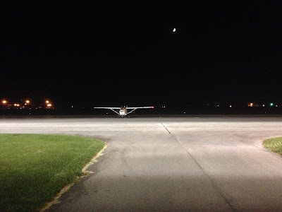
Back up to Michigan - at night!

Plane: Cessna 172 
Route: 40I-OZW
Weather - 40I: Clear, 80 degrees, wind 290 degrees at 5 knots
Weather - OZW: Clear, 67 degrees, wind calm

It's getting to the point that 40I-OZW is a route I can traverse without a map. We had to head back up to Howell again to tend to my dad. Gina and I both worked all day so we planned a (partial) night flight. Good thing I've managed to maintain my currency most of this year!

There are reason one does the preflight inspection. Today I realized the landing light wasn't working. While not absolutely required, it seemed prudent to have one at my disposal for my first night landing at OZW. So our departure was delayed by a few minutes while Emerson grabbed a new bulb from the hangar and kindly installed it in the port wing.

Night flights don't produce much to see until short final... but the sunset sure was spectacular!

We were in the air by 6:30 and I quickly turned on course. The skies were CAVU near home, though a cold front was slowly moving southeast across Michigan. I knew from the forecasts that we'd make it up there with no issues. But I wasn't 100% sure if any clouds would necessitate an early descent from our 5,500 foot cruise altitude.

You could easily see 50 miles - away from the sun, at least

The evening haze was more apparent looking west at downtown Dayton

It was certainly a beautiful evening to fly. Night flying is wonderful - not just due to the sparkling view of towns and cities below, nor the ease of spotting traffic, but especially because of the smooth air. Trimmed out, I was able to fly mostly hands-off and enjoy the view of sun dipping below the horizon as we cruised northward.

That view and she's on her Nexus?! The pilot in me shakes his head... :)

By the time we crossed the Michigan-Ohio border, it was quite dark outside. I saw some clouds to the northwest accented against the last gasps of daylight; they were still safely above our altitude. Before long, however, it was time to begin our scheduled descent. I slowly let down to 2,000 feet at around 300 fpm.

I spotted Livingston County's rotating beacon 20-25 miles out and notified Detroit Approach. They cut me loose with a friendly "squawk VFR"  about 10 miles later. The pattern was empty and - at least at a somewhat unfamiliar airport - I prefer a slightly longer final at night, so I flew towards the final approach fix on the approach plate for Runway 31. That put me on a roughly two mile left base. I turned final, maintained the glideslope with the PAPI, and touched down really, really softly with nary a squeak precisely two hours after takeoff.

Taxiing into a tiedown spot onto the ramp at OZW

Since my sister was still on her way to pick us up and - admittedly, my primary reason - I try and take advantage of any opportunity to extend my night currency, we made three more circuits around the pattern. None of those landings were quite as good as the first one (quit while you're ahead and whatnot...) but all went well and, within minutes, I was  legal to carry passengers at night for another 90 days. Heavy rain moved in a few hours later as promised, but by then we were comfortably relaxing indoors. 

Flight Track: Google Earth KMZ File 
Today's Flight: 2.6 hours
Total Time: 319.4 hours

Friday, September 26, 2014

Certified in the small Cub again

Plane: Cub, 65 hp 
Route: 40I, Local 
Weather: Clear, 77 degrees, wind 060 degrees at 6 knots

I've needed to get checked out in the little Cub again for months. They changed the trim wheel (during its last annual, I think) and it operates a bit differently than the old one. So everyone has been required to fly it with an instructor before they can fly it again solo.

Since I was at the airport all day - helping a friend prepare for a private airshow - and the weather was beyond perfect, I snagged CFI Dave and N77500 for a few minutes to finally check the checkout off my to-do list. I hadn't flown with him in over two years! Flying aside, it was great to hop back in the cockpit with a familiar face.

0.3 on the Hobbs doesn't consume much map real estate!

He had me climb straight out to 2,500 feet, make a turn, roll in full nose up trim, and let go of the stick. The nose quickly rose through the horizon - which was the point of the lesson. The old trim couldn't apply anywhere near as much force. I pulled on the carb heat, held the stick back against my chest, and did a couple power-off stalls. Dave kicked in a bit of left rudder but I countered and we avoided a full spin.

That was all he needed to see, so we turned back towards Stewart. Abeam the numbers I pulled the throttle to idle and he told me to land at the third set of cones. I pushed in full rudder, a bunch of left stick, and turned from downwind to final in a full slip. We touched down maybe 10 feet before the cones. That wouldn't have met every FAA requirement, but Dave was satisfied with my total greaser. I was, too.

Total time from decision to fly to engine shutdown: 30 minutes, tops. Gotta love Stewart.

Flight Track: Google Earth KMZ File 
Today's Flight: 0.3 hours
Total Time: 316.8 hours

Tuesday, September 16, 2014

Flying from few to solid overcast on the way home

Plane: Cessna 172
Route: OZW-40I
Weather - OZW: Few clouds, 64 degrees, wind 300 degrees at 7 knots
Weather - 40I: Overcast, 60 degrees, wind 330 degrees at 5 knots

After a couple days in Howell, it was time to head home this afternoon. I'd been tracking the forecast since I flew up and, with each update, the clouds in Ohio were expected to clear later and later. But the weather was still VFR and I knew I'd make it. The trip just required slightly more advance mental planning, which ended up working out great.

My sister dropped me off at Livingston County Airport just past 3:00. I wheeled my bag out to the 172, loaded everything in the baggage compartment, untied the tie-downs, and did a thorough preflight. All checked out so - since I'd topped off the tanks upon arrival - I started the engine and taxied down to the end of Runway 31.

You can definitely observe the changes in cloud cover at 8x actual speed

There were a few other planes inbound and one called a few miles out, planning to land on Runway 13. Traffic had been using 31 and I was sitting at that end, so I made my "taking off on Runway 31" call. He came back on the radio asking what runway was in use, I said the wind was mostly down 31 but I'd be out of there in a minute. In the end, he changed his mind and entered the pattern for 31.

The sky was nearly clear in Michigan so I decided to climb to 4,500 feet, knowing I'd likely have to descend partway home. I knew there was better radar coverage up there, which would facilitate the handoff from Toledo Approach to Indy Center - should I be able to remain high enough, long enough. On the way up at 3,500 feet, Columbus Approach couldn't hand me off to Indy and I had to call Toledo and restart flight following from scratch.

Interstate 94 west of Ann Arbor

Crossing over the Maumee River southwest of Toledo

While there were some bumps, the air was smoother than Sunday. I hit some good pockets of rising and cooling air along the way but overall spent far less time correcting my heading and altitude. Visibility was again spectacular, easily 50+ miles for the first half of the flight.

Clouds were still scattered at this point

Near Lima the clouds began to increase in coverage and their bases began to drop. Thankfully, I was able to hold 4,500 feet just long enough to get the handoff to Columbus Approach. As soon as I checked in with them I began a slow descent to 2,500 feet. It's always nice when you plan ahead and it works out in the air.

Columbus vectored me east towards Springfield to avoid Dayton's arrivals/departures and C-17s practicing approaches at Wright-Patt. I got a nice view of the behemoths turning in the pattern as I made my way south. Roughly abeam the Air Force base they turned me back on course. Visibility was still fine, probably 20-30 miles, but the clouds had become a solid overcast. And that's why I descended earlier!

Now underneath a broken layer somewhere east of Sidney

A familiar landmark for Dayton locals - Young's Jersey Dairy

I called Stewart in sight a bit over 10 miles out. Approach cut me loose, I squawked VFR, and made my final descent to pattern altitude. There was only a Cub in the pattern as I crossed midfield and turned downwind for Runway 26. The wind was light and I managed one of those awesome 172 landings where I had the yoke all the way back, stall horn blaring, right as the mains touched the grass. Not a bad way to end a trip.

Even factoring in my time on the ground in MI and my drive home, I still saved 45 minutes compared to driving. And there was far less traffic. On a related note, this was another good example of a flight where an instrument rating would've been quite handy. Instead of the mid-flight descent, I could've flown all the way at 8,500 feet to take advantage of a (slightly) better tailwind before descending through the clouds near Dayton. Oh well, it'll happen. In due time.

Flight Track: Google Earth KMZ File 
Today's Flight: 2.0 hours
Total Time: 316.5 hours

Sunday, September 14, 2014

Solo flight to Michigan for a family visit

Plane: Cessna 172 
Route: 40I-OZW
Weather - 40I: Scattered clouds, 64 degrees, wind 090 degrees at 4 knots
Weather - OZW: Broken clouds, 60 degrees, wind 220 degrees at 8 knots

I needed to head up to Michigan to see my dad this afternoon. I drove up last week and wanted to save some time; the weather was also much more conducive to flying today. So, with the plane reserved for about 48 hours, I hopped in the 172 after lunch and pointed the nose north.

Highlights from tonight's slightly-less-than-two-hour flight (lots of ATC)

Columbus Approach quickly issued me a squawk code when I called for flight following abeam Wright Brothers. They turned me about 10 degrees right to stay clear of the arrivals/departures at DAY but the frequency was relatively calm; most calls were planes from the local drop zones announcing "jumpers away." Eventually I got cut loose at the end of their airspace near Lima.

North of Lima, I called Toledo Approach. They were able to get me into the system so I'd have flight following the rest of the way. That frequency was also pretty quiet, save for a few guys hugging Lake Erie's south shoreline on the way to Put-in-Bay.

Sometimes navigation's too easy; I followed this road for about 50 miles

Eventually I got handed off to Detroit Approach, which moved me about a mile west near Tecumseh to avoid a jump zone. Other than that, it was bumpy sailing the remainder of the way to Howell. A couple other planes were in the pattern but left the area before I entered. I crossed midfield to enter a left downwind for Runway 13. The wind was steady at 8-10 knots, a direct right crosswind that I negotiated on short final. Landing intentionally long to shorten my taxi to the fuel pad, I touched down pretty softly on the right main after a slight initial balloon.

I have to note that it was seriously bumpy. For the entire flight. Not enough to make me nauseous or anything (though I was glad to be flying solo) but the bumps never let up. I was constantly on the controls trying to maintain a semblance of the correct altitude and heading. Climbing to get above the bumps wasn't a great option since the cloud deck was broken (I'd have had to go to 7,500 feet to be high enough above the clouds - and find a hole to descend through in Michigan) and then I'd also be trading calm winds aloft for a headwind. On the flip side, visibility was spectacular - I spotted Detroit and Columbus from >60 miles away!

OZW has a beautiful new terminal (and intimidating ramp decorations)

The drive is between three and half and four hours; today's flight was a bit under two hours. Of course, I spent some time taxiing, running checklists, and filling up the tanks at the self-serve 100LL pump (with a $0.20/gal discount on weekends!) after I landed. However, the view was certainly a hell of a lot better and that qualifies as an unquestioned success in my book.

Flight Track: Google Earth KMZ File 
Today's Flight: 2.2 hours
Total Time: 314.5 hours

Thursday, September 11, 2014

Caesar Creek Soaring Club's Youth Camp

I just came across this and absolutely had to share it. It captures the magic of flight - and sharing it with kids in particular - in spectacular fashion. Just a damn fine video all-around.


Caesar Creek Soaring Club is only a few miles (by air, of course) from Stewart. I've landed there numerous times myself, including on my first-ever Cub lesson. If you're interested in glider flying, they're a great place to check out!