Showing posts with label Safety Pilot. Show all posts

Friday, August 15, 2014

Summertime safety piloting

Plane: Cessna 182 RG
Route: MGY, Local 
Weather: Clear, 74 degrees, wind 300 degrees at 4 knots

This summer has felt and looked a lot more like fall. That trend continued today with extremely comfortable temperatures and great visibility; I'm pretty sure you could see 50-60 miles from a couple thousand feet above the ground. Mike needed to shoot some approaches and we originally planned to fly tomorrow morning. However, we'll both be busy biking the Tour de Dayton, so we pushed our original plans up and went flying tonight after work.

Flying over my office in the Miami Valley Research Park

Kettering Fairmont High School, where Gina teaches

We took off from Wright Brothers around 6:00 and headed north. Mike made a teardrop entry into the approach for Runway 23 at Middletown. There were skydivers in the pattern as usual (there's a very busy skydive outfit at MWO) and I kept them in sight as Mike flew under the hood. He went missed at decision height and I told him to climb slowly at first - there were still open parachutes nearly directly above us.

Soon we were again level at about 3,000 feet and lined up for an approach to Runway 33 at RID. Mike had already knocked off a bit of the rust and this one was quite stable. I took some photos of the lush, green farmland surrounding the airport as we shot down final. The pattern remained completely empty as we again went missed and pointed the nose back towards Dayton.

Great Miami River and one of the bike trails I regularly ride

Long final for Runway 33 at Richmond Municipal Airport

Everything is seriously green out here right now!

Shadows cast across a golf course near Richmond, IN

A blimp was flying over Mason, OH (I believe for the Western & Southern Open, a tennis tournament) that lined right up with our initial approach fix; we flew directly at it and it slowly grew in size as we got closer. About five balloons had been getting ready for takeoff when we took off from Wright Brothers (what I assume to be) some of them were visible on the horizon.

That's a hot air balloon about a mile off the right wing

Short final for Runway 2 at Wright Brothers

Two or three other planes called in on the CTAF as we flew the approach to Runway 2, which is roughly 10 miles straight in. Everyone had landed by the time we were on short final and Mike touched down softly a little past the numbers. All told, we spent about an hour in the sky. He's now current and, for me, the view was certainly worth it!

Flight Track: Google Earth KMZ File 
Today's Flight: 0.8 hours (SIC)
Total Time: 312.3 hours

Wednesday, September 4, 2013

Safety piloting and short field landings

Plane: Cessna 172
Route: 40I, Local 
Weather: Partly cloudy, 70 degrees, wind 010 degrees at 4 knots

Jamie needed to shoot some approaches again and it was a gorgeous day out. As if I ever need any extra incentives to hop into the left - or rear, as it may be - seat of an airplane! We met at Stewart after work and I took off on Runway 26 as he donned the stylish IFR hood.

Today's work - approaches at Greene County and Wright Brothers

He shot the first approach into Green County (I19) and then we continued northeast towards Springfield Municipal (SGH) intending to hold over the VOR. We weren't the only folks with that idea. I spotted a C-17 behind us leaving WPAFB's airspace and there was a student down below in the pattern... and then we heard another 172 call entering the hold. Head on a swivel and I spotted them a mile or two away. Jamie wisely decided we'd be safer to bug out than try and coordinate all that so we headed back towards I19 for approach number two.

After Jamie shot his third and final approach at Wright Brothers I flew us back to Stewart. We decided to have a little short field landing contest. I maintained the airspeed pretty slow, around 60 knots, on final but touched down a bit long - it's amazing how much stall/landing speeds are reduced by being a few hundred pounds under gross. Jamie had a go the next time around. With the stall horn blaring, he touched down, uh, firmly, although still a tad long. I don't think we left any parts on the runway. I brought the plane around for the third and final landing, chopping the power over the trees and dropping the 172 in with all 40 degrees of flaps, and was turning off abeam the end of the hangars - or in about 650 feet. Good times.

Flight Track: Google Earth KMZ File 
Today's Flight: 1.0 hours
Total Time: 289.6 hours

Sunday, August 25, 2013

Hot and bumpy approaches

Plane: Cessna 182 RG
Route: MGY, Local (Approaches at ILN, I66, MGY)
Weather: Clear, 83 degrees, wind 090 degrees at 4 knots

Mike needed to knock out five more approaches to maintain his instrument currency so he decided to knock them all out this afternoon. We met at Wright Brothers around 2:00 and headed east towards Wilmington. It just kind of works out that the missed approach off Runway 4L at ILN puts you in position for the initial approach fix for Runway 21 at I66 - and vice versa. So that was the plan - two of each, followed by an approach at MGY.

It was hot, sticky, and bumpy this afternoon. Needless to say, Mike wasn't overjoyed to be under the hood for most of it. Neither of us have ever gotten airsick (and certainly didn't today) but we both felt a tad nauseous mid-flight. It was just downright unpleasant up there. I flew for a few minutes while Mike stared out the windows between the last approach at I66 and initial approach fix for our return to MGY.

We flew the approach for Runway 2, breaking off about a mile short of the runway to enter the pattern and circle to land on Runway 20 behind a departing twin. As much as I love to fly, it felt great to be on the ground again. Both of us popped open our windows and enjoyed the hearty breeze!

Today's Flight: 1.0 hours (SIC)
Total Time: 286.8 hours

Wednesday, August 14, 2013

Flying an aerial hitchhiker to West Virginia

Plane: Cessna 182 RG
Route: MGY-OSU-MGW-MGY
Weather - MGY: Broken clouds, 67 degrees, wind 030 degrees at 6 knots
Weather - MGW: Clear, 63 degrees, wind calm

Mike sent me an IM this afternoon and asked if I wanted to fly to WV on an interesting mission. I forget the exact connection but Matthew Karsten, a.k.a. The Expert Vagabond, is a friend of a friend. He's in the midst of one heck of an adventure, hitchhiking his way across the country and writing about it on his impressive travel website. Matthew was in Columbus looking for a ride east today and Mike offered to do his part to help out.

So we met at Wright Brothers around 5:00 and were soon climbing out over the clouds, heading east towards Ohio State University Airport. There was a bit of a dual mission, as Mike needs to log some approaches under the hood to stay instrument current - hence me tagging along. We were on flight following with Columbus Approach and got cleared to fly the RNAV 9R into OSU.

Xenia, OH - which has been hit by three tornados since 1974!

London, OH and the Madison Correctional Institution

Crossing the Scioto River with downtown Columbus in the distance

Final for Runway 9R at KOSU

Bonus points to any airport with a public observation tower!

We met Matthew in the terminal and chatted for about 15 minutes while the line folks added 40 gallons of Avgas to the 182's fuel tanks. He had traveled to Columbus from Colorado by way of a big rig - roughly 1200 miles in one shot! This would be his second time in a small plane, and I think his very first in a four-seater.

He was really looking forward to the trip and asked a bunch of great questions about flight training and general aviation. Mike and I enjoyed the chat and continued answering questions and explaining things as we loaded into the airplane. After we were settled, Mike started the engine and got clearance to taxi back to Runway 9R for takeoff.

Hitchhiker and pilot prior to climbing into the airplane to fly to WV

OSU's campus is in between us and downtown Columbus in this shot

Mike pointing something out while climbing to 7,500 feet

Matthew seemed to be enjoying the view!

There were some scattered clouds that thinned out as we flew east

Passing directly over top of Zanesville, OH

Fracking = lots of chopped-off hilltops in the region

The winds aloft were light and we were making good time to Morgantown. Mike and I pointed out some of the neat things you can see from above in this part of the country - hills with flattened tops where they're drilling for natural gas, coal mines, all the coal-fired power plants along the Ohio River, and the rolling terrain. We also chatted about how much time you can save by flying in areas like this where there simply aren't many roads that cut straight across the landscape.

Maxing out at 213 MPH groundspeed on descent into MGW

Morgantown, WV

Matthew was still enjoying the heck out of the flight shortly before landing

Final for Runway 36 at Morgantown Municipal Airport

On the ground, we probably talked for another 30 minutes about Matthew's plans as he continues on his journey. He was going to stay the night in Morgantown and then continue east - first towards Washington, DC and ultimately up the east coast to Boston. He has a flight from Boston to Mexico in a few weeks and then he's going to spend three months living down there. It's certainly not a lifestyle for everyone but you can't deny it's one heck of a journey!

Mike and I actually flew to Morgantown a couple years ago on a Pilots N Paws flight. The FBO still has a great pilot lounge but we were sad to see the new management has apparently started charging a $15 landing fee for the privilege of using their chocks. Ouch! Although we enjoyed our meal at Ali Baba back in 2011 (it's still open) I don't think MGW is going to be such an easy sell as a $100 hamburger destination anymore.

The sun was getting low in the sky as we taxied for takeoff

Flying over West Virginia University's campus on our way home

The flight home was uneventful as the sun slowly got lower in the sky and eventually dipped below the horizon. Winds were still relatively calm and we maintained about 150 knots across the ground. The pattern at Wright Brothers was clear and the radio silent as we turned final for Runway 20. Mike touched down gently and we quickly washed the bugs off the plane and locked N757YG up in her hangar.

It was a fun little evening trip to WV and back. I enjoy tagging along like this sometimes since it affords me the opportunity to use my good camera in the air. Best of luck to Matthew as he continues his trek across the country - and beyond!

Flight Track: Google Earth KMZ File 
Today's Flight: 0.2 hours (SIC)
Total Time: 280.8 hours

Thursday, June 27, 2013

A little left-seat right-seat

Plane: Cessna 172
Route: 40I, Local 
Weather: Scattered clouds, 85 degrees, wind 270 degrees at 9 knots gusting to 18

Jamie needed to shoot a few approaches and holds to maintain his instrument currency and I was up for the task, so we decided to go flying this evening. I beat him to the airport (he had to drop his son off at practice) so I preflighted the plane, fueled up, and - since he still wasn't there - took it around the patch once before he hopped onboard. With strong winds right down the runway, I set up for a short field landing with all 40 degrees of flaps and was stopped roughly 600 feet after touching down on the grass. Not bad!

Back to the safety piloting... Jamie climbed onboard and into the right seat. He's a CFI and he decided to do all the hood work from that side of the instrument panel. I took off and headed west as he put on the hood and flipped through his charts. Or whatever the equivalent of "flipping through" is called on an iPad.

We exchanged controls and he went to work - shooting approaches into both runways at Wright Brothers and then doing some holds over top of Stewart. The GPS in the 172 has been a bit flaky as of late. I've never had issues with it on an XC but it loses signal or otherwise fails intermittently when an approach is active. Obviously that wouldn't be so hot in actual instrument conditions. They're aware of it and the plane shall be visiting the avionics shop soon.

Hood work complete, Jamie handed the controls back to me over the airport and I flew south, did a steep spiral to very quickly descend from 2,500 to 1,800 feet, and entered the pattern. I pulled the power abeam the numbers for a simulated engine-out landing. The touchdown was nice and smooth, one of my better recent attempts in the Skyhawk. Whether as student or co-pilot, it's always nice to fly with Jamie and tonight was no exception.

Flight Track: Google Earth KMZ File 
Today's Flight: 1.5 hours
Total Time: 273.2 hours

Saturday, March 23, 2013

Safety pilot time with Jamie

Plane: Cessna 172
Route: 40I,-MGY-40I
Weather: Overcast, 34 degrees, wind calm

Jamie, who I flew with last fall and recently completed his CFI - he's now an instructor at Stewart, needed a safety pilot this morning. We took trusty old 2814L out for a couple approaches to MGY under the hood. I kept my eyes open and didn't see much, if any, traffic on this cold spring morning.

Looks like the RNAV RWY 2 approach chart - funny how that works, huh?

After the second approach, Jamie landed (we went missed the first time) and we switched seats. He had me fly back to Stewart and I set up for a short field landing. In a well-timed moment of skill, I totally nailed it with an instructor in the right seat. I slowed to about 60 knots and brought in all 40 degrees of flaps on final, chopped the power as soon as we crossed the power lines, and made an extremely soft landing. Touchdown was less than 100 feet past the threshold and I turned off about 900 feet down the runway. Maybe I'm weird, but that never gets old.

Flight Track: Google Earth KMZ File 
Today's Flight: 0.9 hours (0.6 SIC / 0.3 PIC)
Total Time: 258.7 hours

Friday, November 30, 2012

A little more night from the right

Plane: Cessna 182 RG 
Route: MGY, Local (Approaches at I66)
Weather: High overcast, 47 degrees, wind 200 degrees at 6 knots

Mike sent me an IM this afternoon and said he wanted to brush up his skills under the hood. He hadn't flown since we went up three weeks ago. There was a high overcast but otherwise it was a perfect night with great visibility. We met at Wright Brothers around 5:30 and were in the air about 20 minutes later.

The indoor view, shortly after we climbed in

The approach lights were OTS at ILN, which is where Mike had planned to go practice. With that option off the table, he elected instead to fly a couple approaches at nearby I66. We came in once from each direction; the second approach was definitely more stable than the first. It really can be a bit disconcerting at night to see just how low you are when the approach levels you off to look for the airport!

Approaching the Dayton Mall

Dayton Mall again - that's I-675 on the left

Final approach for Runway 20 at MGY

Walmart and the Dayton Mall

 Passing over out neighborhood - my Christmas lights are quite bright! :)

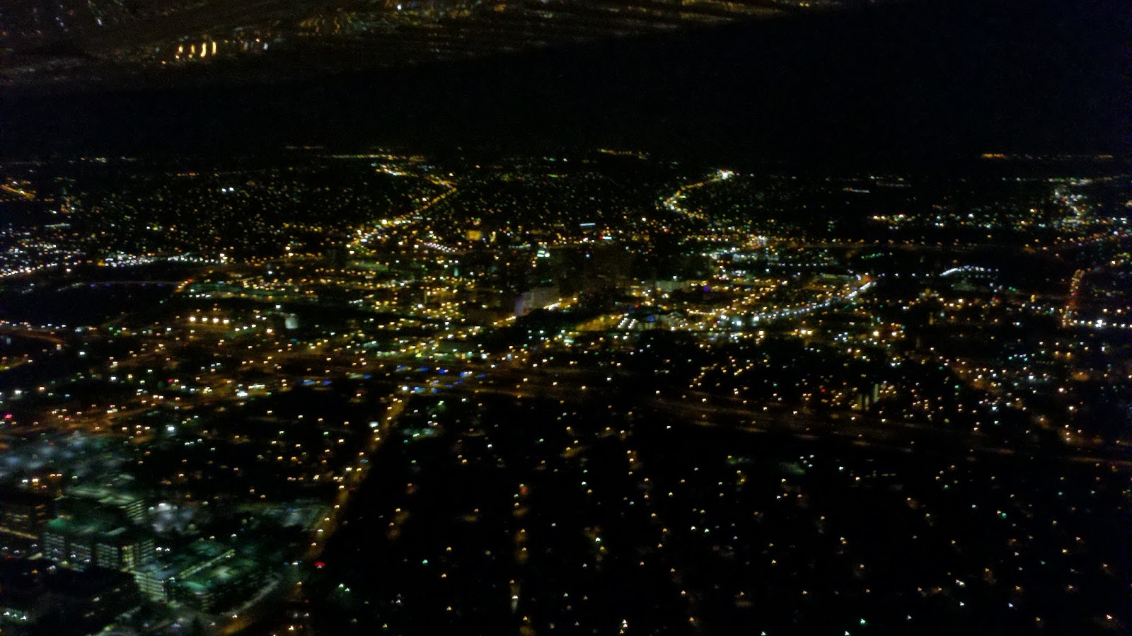
We headed back to MGY after those two approaches and Mike shot the GPS into Runway 20 there. You can see from my not-great-but-still-neat photos above that we passed over some well-lit local areas on the way in. That and the fact that my Christmas lights at our house are wonderfully visible from above! Night flight sure does produce some awesome views.

Flight Track: Google Earth KMZ File 
Today's Flight: 0.8 hours (SIC)
Total Time: 249.8 hours

Thursday, November 8, 2012

Sitting on the right at night

Plane: Cessna 182 RG
Route: MGY, Local (Approaches at DAY)
Weather: Clear, 42 degrees, wind calm

Mike wanted to knock out a little hood time tonight. It was completely clear and the crisp fall air sure makes for some of the smoothest flying. Best of all, it was a chance to see the local area from above at night. It's been far too long since I last flew at night - 1197 days, to be precise.

We shot two ILS approaches to Runway 24L at Dayton International. Other than another Cessna (that appeared to belong to OSU's aviation program) also practicing an approach and two jets landing on Runway 18, the radios were all but silent. Following the second approach, we turned south and passed over downtown Dayton before landing back at Wright Brothers.

Our first approach into DAY

Long final on the second approach

Crossing over the Great Miami River and downtown Dayton

Looking back towards the city; Miami Valley Hospital is in the bottom-left

You'll have to forget the cameraphone quality of the photos. Still... it's a view that's hard to beat!

Today's Flight: 0.3 hours (SIC)
Total Time: 248.2 hours

Saturday, September 29, 2012

Breakfast and some time in the right seat

Plane: Cessna 182 RG
Route: MGY-I74-MGY 
Weather: Clear, 64 degrees, wind calm

Mike's quite close to his Instrument checkride at this point (passed his written last week - good job man!) and wanted to get in some hood time on this smooth fall morning. We met at Wright Brothers around 9:00 and took off towards Springfield. Columbus Approach vectored us out past the airport and then turned us back west to shoot the VOR 24 Approach.

Final approach into Springfield

Once he pulled the hood off (the minimums are interesting - you're pretty dang high and right over the airport at the missed approach point) we climbed back up and pointed the nose towards Urbana. We spent about an hour on the ground recharging our internal fuel tanks with the Airport Cafe's usual tasty breakfast fare. As to this next point... yes, I realize I'm slightly biased. Anyway, their famous pies are good but Gina's (she's been selling them at Stewart for the past few months) really are better; completely from scratch with fresh - not canned - fruit!

This morning's breakfast destination

Back in the air, Mike thought about shooting an approach at DAY but the winds had them using Runways 06 and 18. That would've resulted in a loooong vector past the airport. So instead he elected to head back to Wright Brothers and threw the hood back on for the GPS 20 into MGY.

Passing by downtown Dayton on our way home

It was a fun morning. The weather was perfect and breakfast was tasty. I headed down to Stewart afterwards to help out with a private airshow they were hosting. It was an extremely long day but time flies (and is too much fun) when said day is spent surrounded by airplanes!

Flight Track: Google Earth KMZ File 
Today's Flight: 0.7 hours (SIC)
Total Time: 245.0 hours

Friday, September 14, 2012

A little more safety piloting

Plane: Cessna 182 RG
Route: MGY, Local (Approaches at RID, DAY)
Weather: Overcast, 62 degrees, wind 010 degrees at 8 knots

Mike grabbed me again for a little hood work this evening. A weak front moved through earlier in the afternoon and took with it the low ceilings and rain. By the time we met at Wright Brothers around 6:00 the weather was great for flying. Mike took off on Runway 02 at MGY and we were soon heading towards Richmond, IN.

Short final for Runway 06L at Dayton Int'l Airport

Looking down on the control tower and terminals at DAY

Final for Runway 24 at Richmond Municipal Airport

He practiced a hold at RID and then shot three approaches; the VOR 33 into RID, the ILS 06L over at DAY, and finally the ILS 24 back at RID. It was a little bumpy at times since we were right at the edge of the front but visibility was great. Mike did a good job with the flying - riding along as Safety Pilot is definitely helping me learn this instrument stuff bit by bit!

Flight Track: Google Earth KMZ File 
Today's Flight: 1.2 hours (SIC)
Total Time: 238.8 hours

Monday, September 10, 2012

Shooting approaches with Mike

Plane: Cessna 182 RG
Route: MGY, Local (Approaches at ILN)
Weather: Clear, 73 degrees, wind calm

It was a gorgeous night out and my friend Mike, who's finishing up his Instrument training, wanted to shoot some approaches. We decided to meet at Wright Brothers around 6:30 - I beat him there by a few minutes and opened up the hangar. After a quick preflight, we launched into the sky. That plane's got some nice get up and go with half-full tanks, two people, and cool air!

Looking back at Wright Brothers Airport after takeoff

Flying past by a bunch of hot air balloons

Final approach for Runway 4L at Wilmington Air Park

He ended up shooting two approaches at Wilmington Air Park; an NDB and a GPS for Runway 4L. It's interesting to see just how non-precise a non-precision NDB approach really is! I kept my eyes peeled for traffic but the sky was ours, save for a CareFlight helicopter that passed through at one point. We flew over Stewart on our way home then landed just past sunset.

Today's Flight: 0.7 hours (SIC)
Total Time: 237.6 hours

Sunday, July 29, 2012

Safety Pilot N Paws

Plane: Cessna 182 RG
Route: MGY-4G1-MGY (Approaches at 4G1, MFD, MGY)
Weather: Scattered clouds, 78 degrees, wind variable at 4 knots

Mike and I had a puppy-filled weekend. Seven little guys flew into Wright Brothers on Friday night from North Carolina. I took four of them, who couldn't have been more than 8-10 weeks old, home with me for the night and Mike fostered the other three. They were cute and cuddly, just as you'd expect puppies to be. See below for proof! :)

When we first got home, they were pretty much inseparable

Getting more cuddly...

These two loved to be close to each other

Contained in the tiled part of the house - as if I need to explain why

No sane person can say no to these adorable little faces, right?

Fast-forward to this morning, when we met at Wright Brothers around 8:00. It was time to fly the pups to Greenville Municipal Airport, just across the OH-PA state line. There we would meet another pilot who was flying them the rest of the way to their new home near Buffalo, NY.

It took a little while to load them into the plane but we were underway around 8:45. The weather was absolutely beautiful on the way up - mostly clear skies and smooth, cool air. The dogs pretty much relaxed in their carriers the entire trip and Mike and I chatted much of the way.

One of the reasons I was tagging along on the trip was to act as a Safety Pilot. For those of you who don't know what that means, it's pretty simple. Mike's working on his Instrument Rating, which will allow him to fly in the clouds. In order to practice (and this would be the same for a pilot who is already Instrument Rated) he has to wear a device that prevents him from seeing outside. Since we're flying in Visual conditions, we are responsible for "Seeing and Avoiding" all other aircraft. Long story short, if one pilot is "under the hood" the FAA requires another pilot on board to watch for traffic and monitor everything. So that's where I came in - I kept my eyes outside and made a couple radio calls whenever Mike put the hood on.

As we approached Greenville, Mike called Youngstown Approach and requested the VOR/GPS Approach into the airport. An instrument approach is basically a series of points and altitudes you fly through in order to safely arrive at an airport in low visibility, clouds, etc. So he flew us down from cruise altitude on instruments until about a mile from the airport, at which point he peeked outside again and made a normal landing.

Puppies and airplanes really do play well together

You can barely see them in there - they slept most of the flight up to PA

Charging at me on the ground at Greenville Municipal Airport

Excitedly meeting the pilot who flew them to their new home

Mike and I attempting to say goodbye to all the energetic puppies

Starting to load the dogs into their second 182 of the day

These guys were quite content just relaxing on the ramp

One final goodbye to this cute little dude

All loaded up and ready for the last leg of their journey

The dogs were all happy to get out of their cages and roam around once we landed, as you can see from the above photos. We chatted with the other pilot for a short while as he met the puppies, then loaded them into his own airplane. It was around 11:00 when we took off and headed back towards Dayton. 

Instead of flying directly home, we first headed towards Mansfield. They are known for having great controllers and quite a few pilots around here seem to practice approaches there. Today it was our airplane taking advantage of their hospitality; Mike flew the ILS Runway 32 Approach. We didn't land - just got down close to the runway then continued on our way home.

One of my favorite sights in the air - clouds reflecting off lakes

Final for Runway 32 during a practice ILS approach at Mansfield

It's always fun passing over Wright-Patterson Air Force Base 

USAF Museum - with their new C-17 parked out on the ramp

Passing downtown Dayton on the RNAV GPS Runway 20 approach into MGY

One more view of the city reflecting off the wing

There's not much else to add. I got to log some time in the right seat, which is good for the pilot side of things. And it's always great to tag along on these Pilots N Paws flights and help out their great organization! If you'd like to learn more about them, volunteer, or make a donation be sure to check out their website.

Flight Track: Google Earth KMZ File 
Today's Flight: 0.8 hours (SIC)
Total Time: 224.5 hours